The Secret of RIPOLL – A strategic location
Ripollès county is located in the Eastern Pyrenees and shares borders with the counties of Osona, Garrotxa, Berguedà and Cerdanya, as well as with the Northern Catalonia.
In this territory the headwaters of the River Ter and the River Freser converge, shaping the area into three geographical zones: Vall de Ribes, Vall de Camprodon and Baix Ripollès.
The Ter and Freser Headwaters Natural Park, declared a natural park in 2015, is a magnificent 14,725-hectare area of high mountainous land in the heart of the Girona Pyrenees.
In terms of its orography, Ripollès’ terrain is extremely mountainous. Most of the summits on the northern side are over 2,000 metres high, the highest being Puigmal at 2,909 metres.
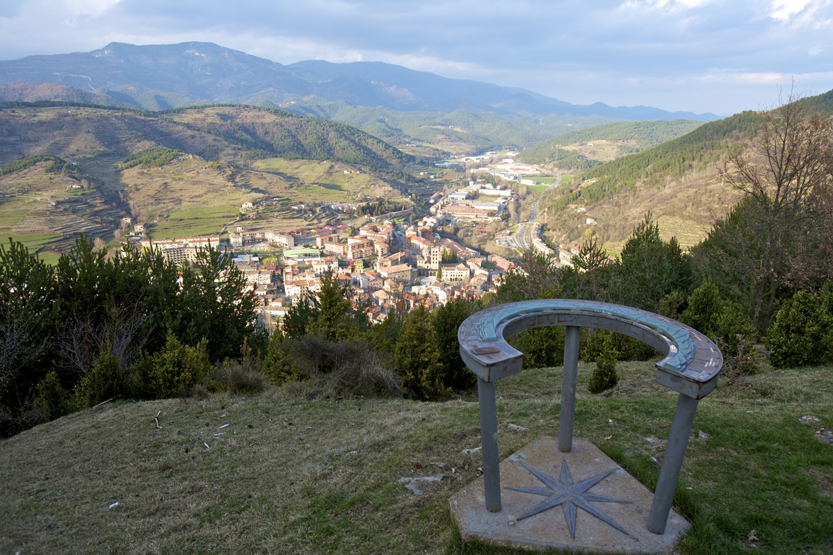
The county contains 19 municipalities, with Ripoll as its capital and most populated hub. This is where the River Freser flows into the River Ter, to follow its course right to the Ter’s mouth in Pals.
The other most populated municipalities on the River Freser are Ribes de Freser and Campdevànol; Camprodon and Sant Joan de les Abadesses are the most populated on the River Ter.
Ripollès is rich in cultural heritage as well as in terms of its nature and scenery.
Kilometers 4,1 km
Slope Variable according to section. Assequible.
Difficulty Minimum
Pavement Asphalt chipboard
Maximum altitude 715 m (Km 3)
Minimum altitude 690 m (Km 0)
Services Station WC's / Tourism Offices
Secret type Historical
Introduction to the Secret Route
The route is designed to reveal Ripoll through different stops around the town showing off the town’s heritage and nature at its most striking. Many of the stops are well-known, but there are also less-known sites that are worth a visit.
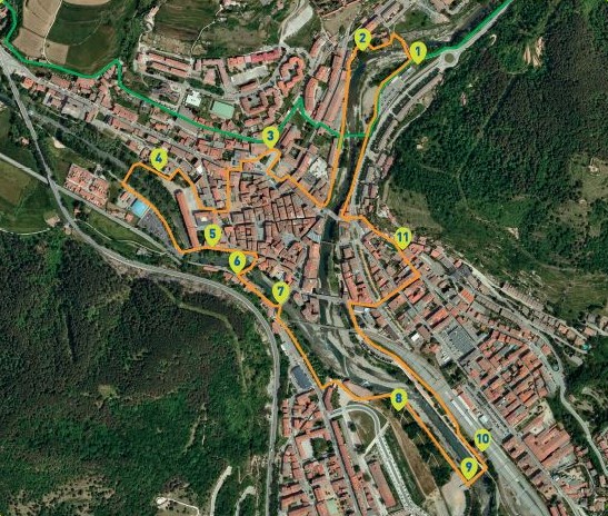
The route takes about an hour. It consists of 13 stops in the old part of the town as well as along the banks of the River Ter and the Freser.
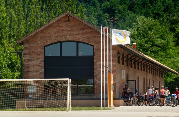
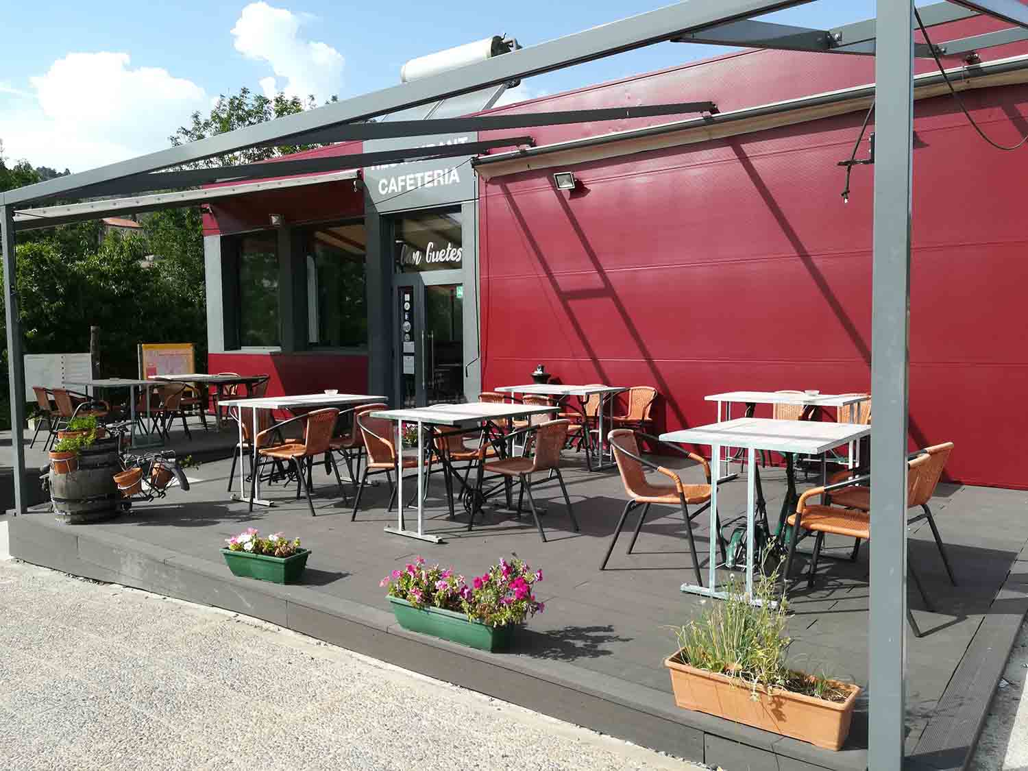
It is a low-difficulty walk. The CAT Can Guetes is both the start and the end point. It is just a few metres from the Iron and Coal Route, so people following that path can easily pick up this route for a pleasant walk around Ripoll. Anyone can enjoy this walk, the start point is just a few metres from the centre and there is a parking area so you can get to it on foot or by car.
Points of interest:
CAT Can Guetes
Start and end point of the Secret Route.
The area in which the carpark now stands was once devoted to agriculture; its flatness and position on the banks of the river would have facilitated the cultivation of crops.
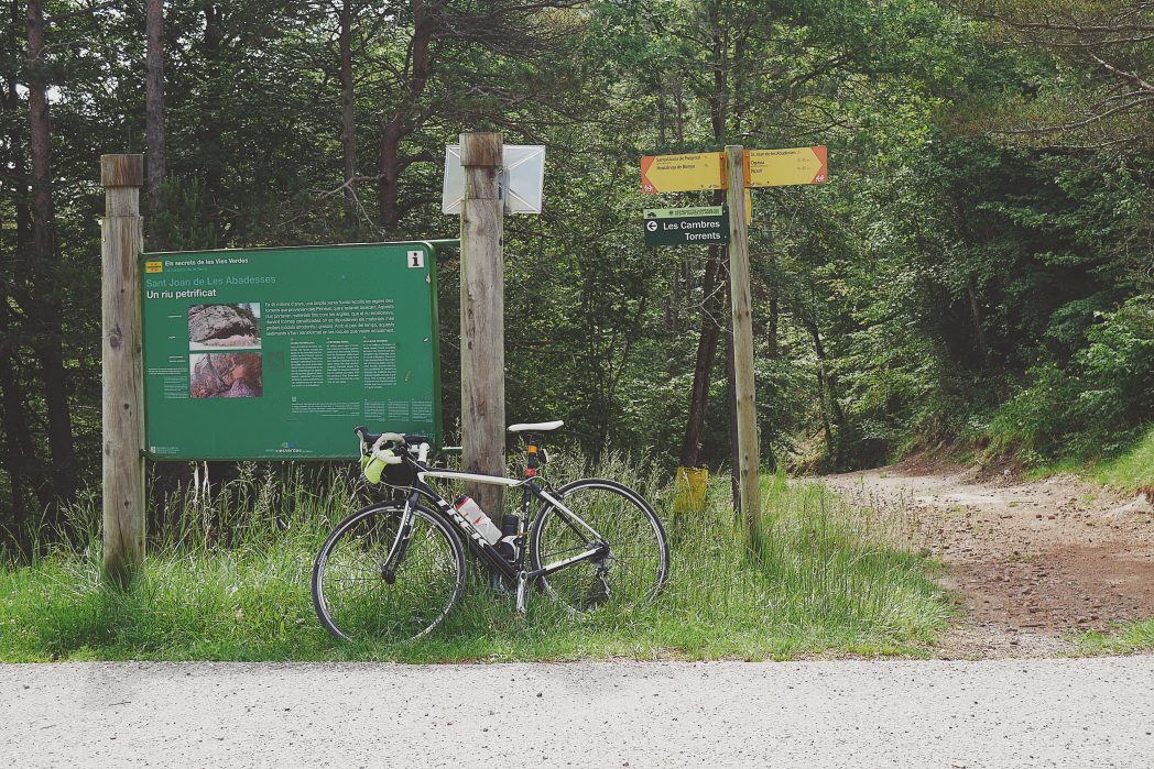
In the place of the C-26 road there used to be a train track that went to Sant Joan de les Abadesses and Ogassa. Its function was to transport coal from the Ogassa mines. When the mines fell into disuse, the track became obsolete.
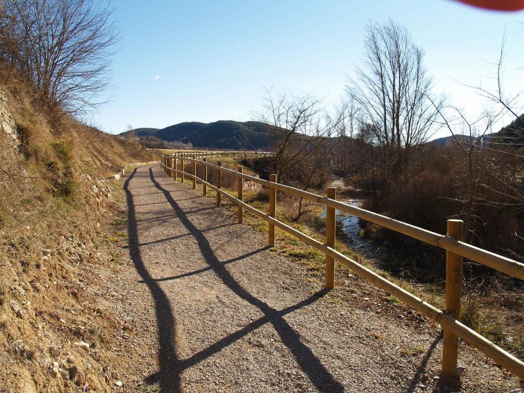
That same route would later become the current greenway and this segment is called the Iron and Coal Route. It is 12-km long and follows the old route of the train tracks and wagons that carried coal from the Ogassa mines; the starting point is a few metres from this stop and it ends up in Toralles.
Can Pòlit washing area
This is one example of the safareigs where, in the not too distant past, people washed clothes and where locals met.
Curved in shape, they are located on the wall of the Can Guetes canal in an open air structure. Near the safareigs you can see the house and factory of Can Pòlit, which used to be a leather tannery. Both buildings are uninhabited and abandoned. These washing areas and those of Can Guetes are the last ones remaining in Ripoll.
A few years ago they were restored, giving them their current appearance.
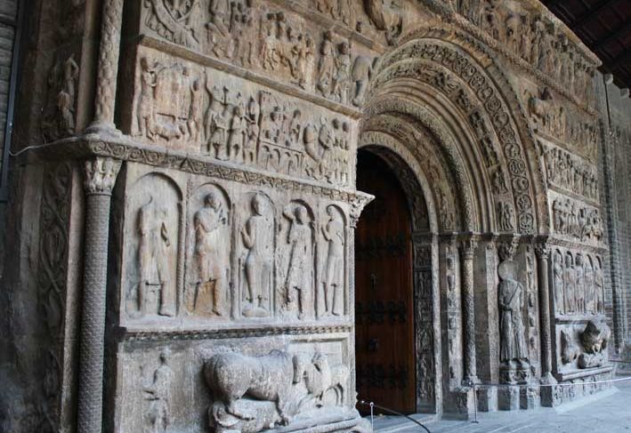
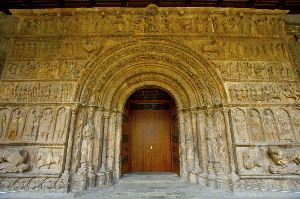
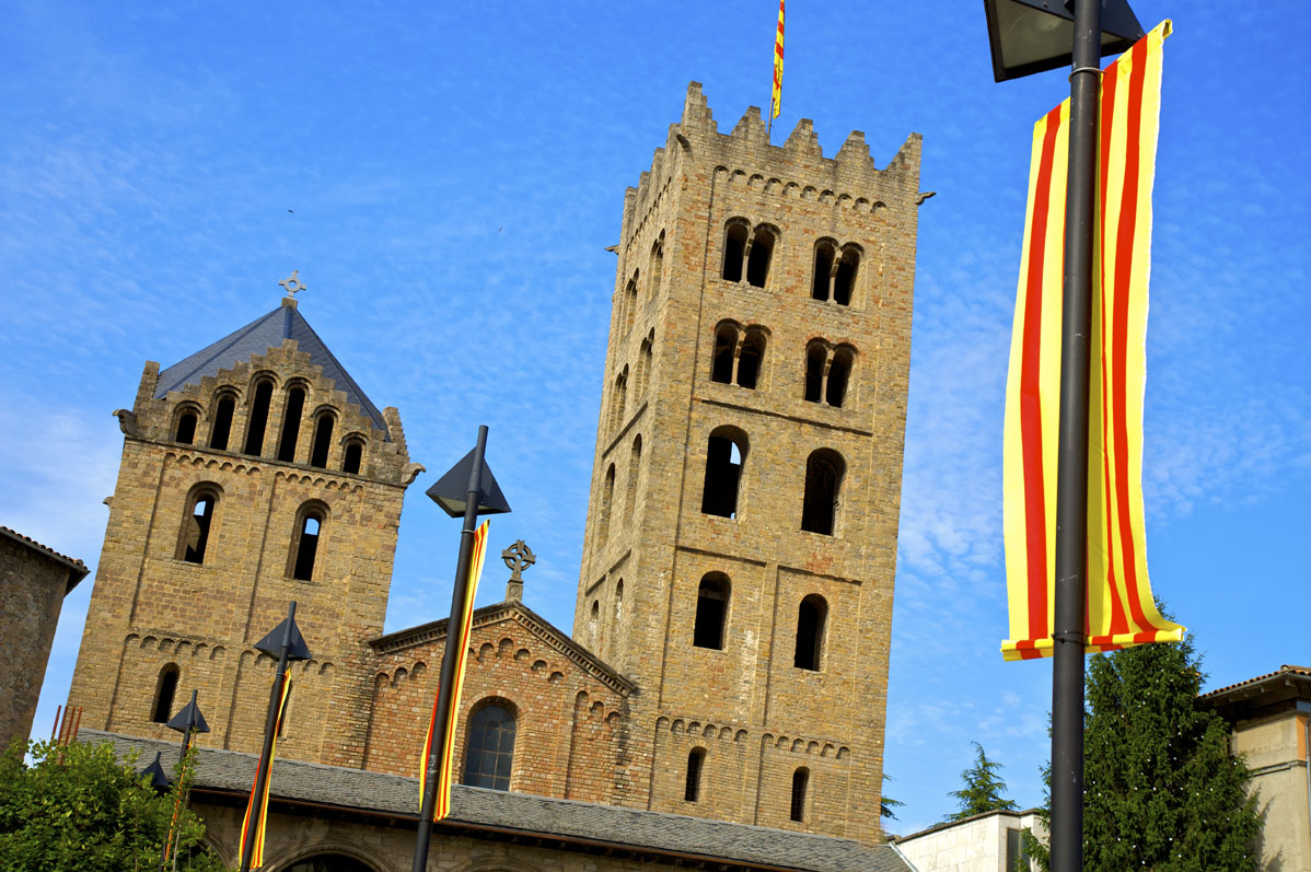
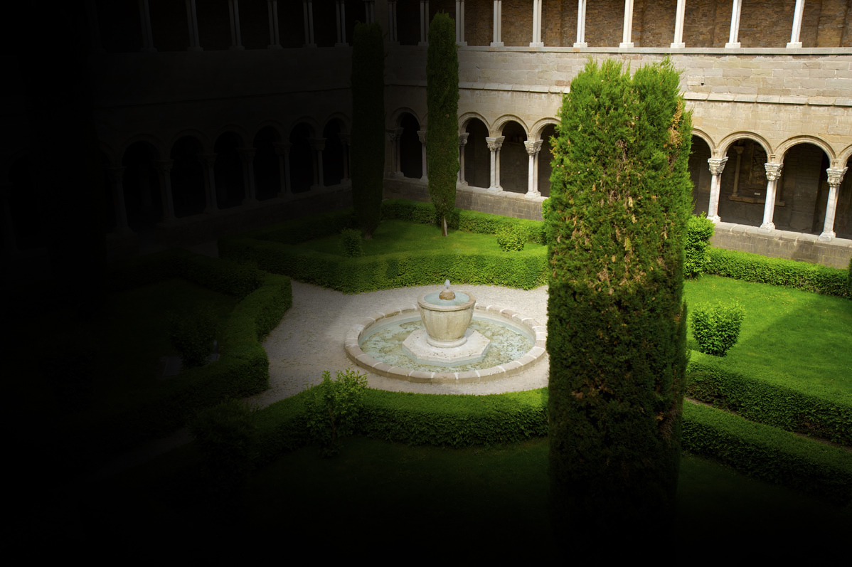
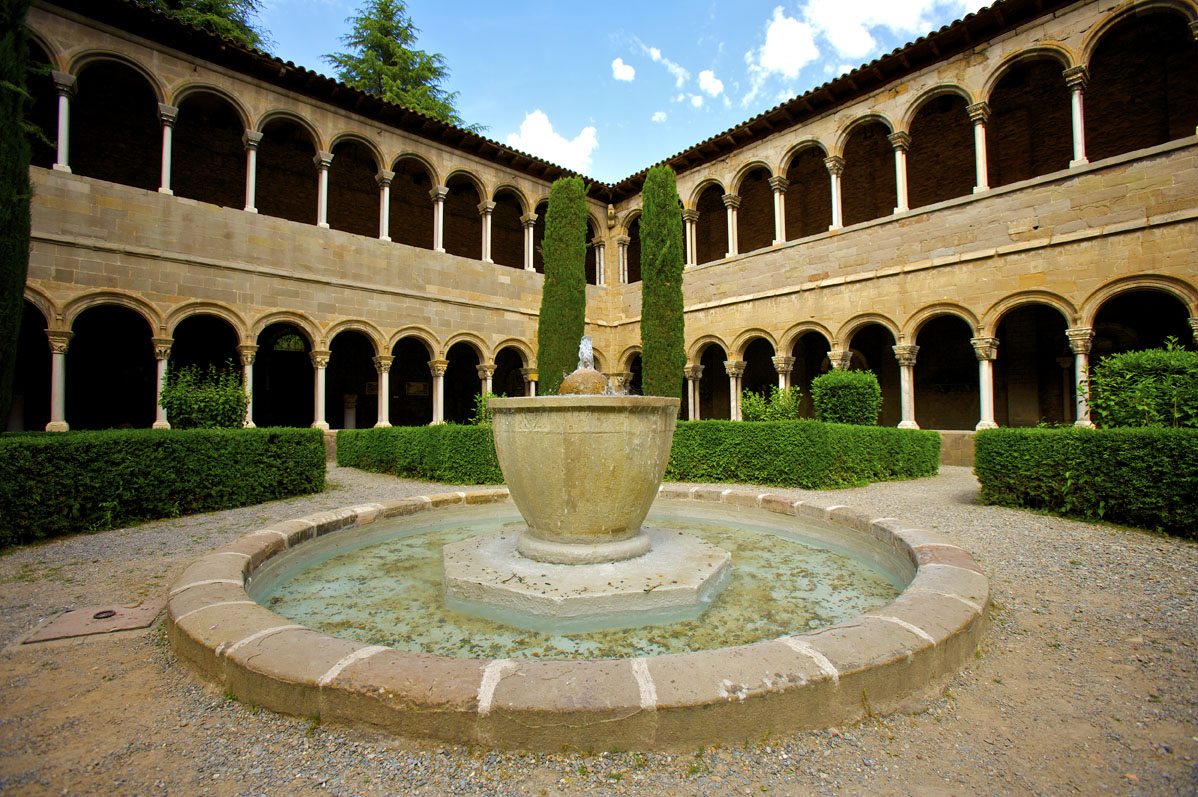
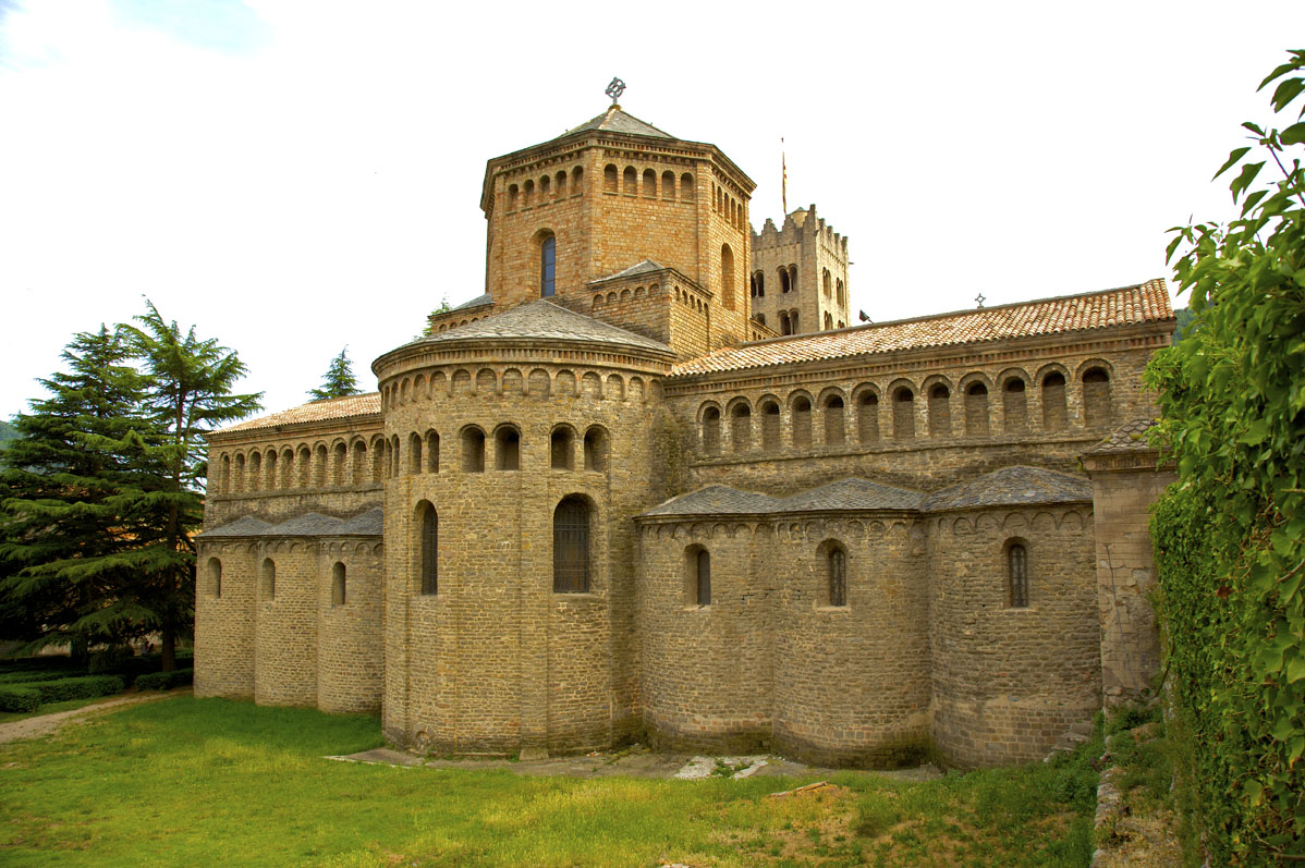
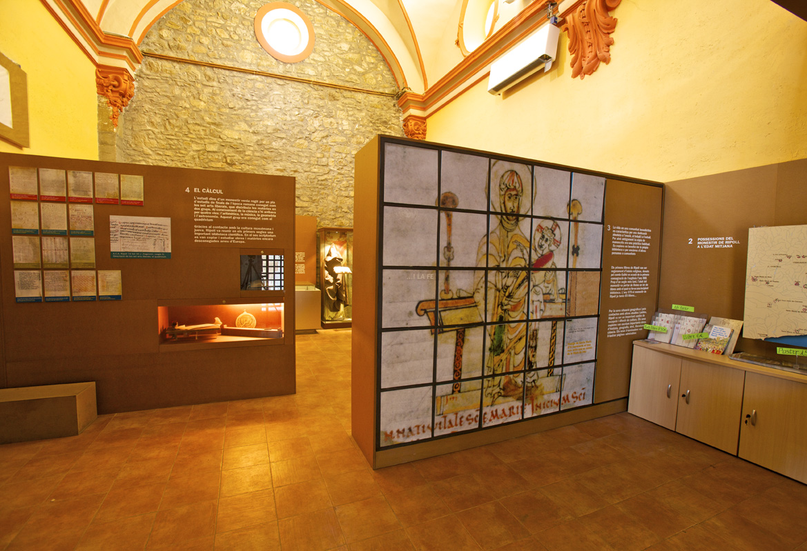
Monastery – Museum – Scriptorium
This is the hub of Ripoll’s cultural scene.
- The monastery of Santa Maria de Ripoll, founded in 879 by Count Wilfred, stands out both for its historic role in the founding of Catalonia (being a Catalan Count’s family mausoleum) and for the artistic value of its Romanesque art, particularly the portal, known as ‘the Bible of stone’, which has been nominated for UNESCO World Heritage Site status.
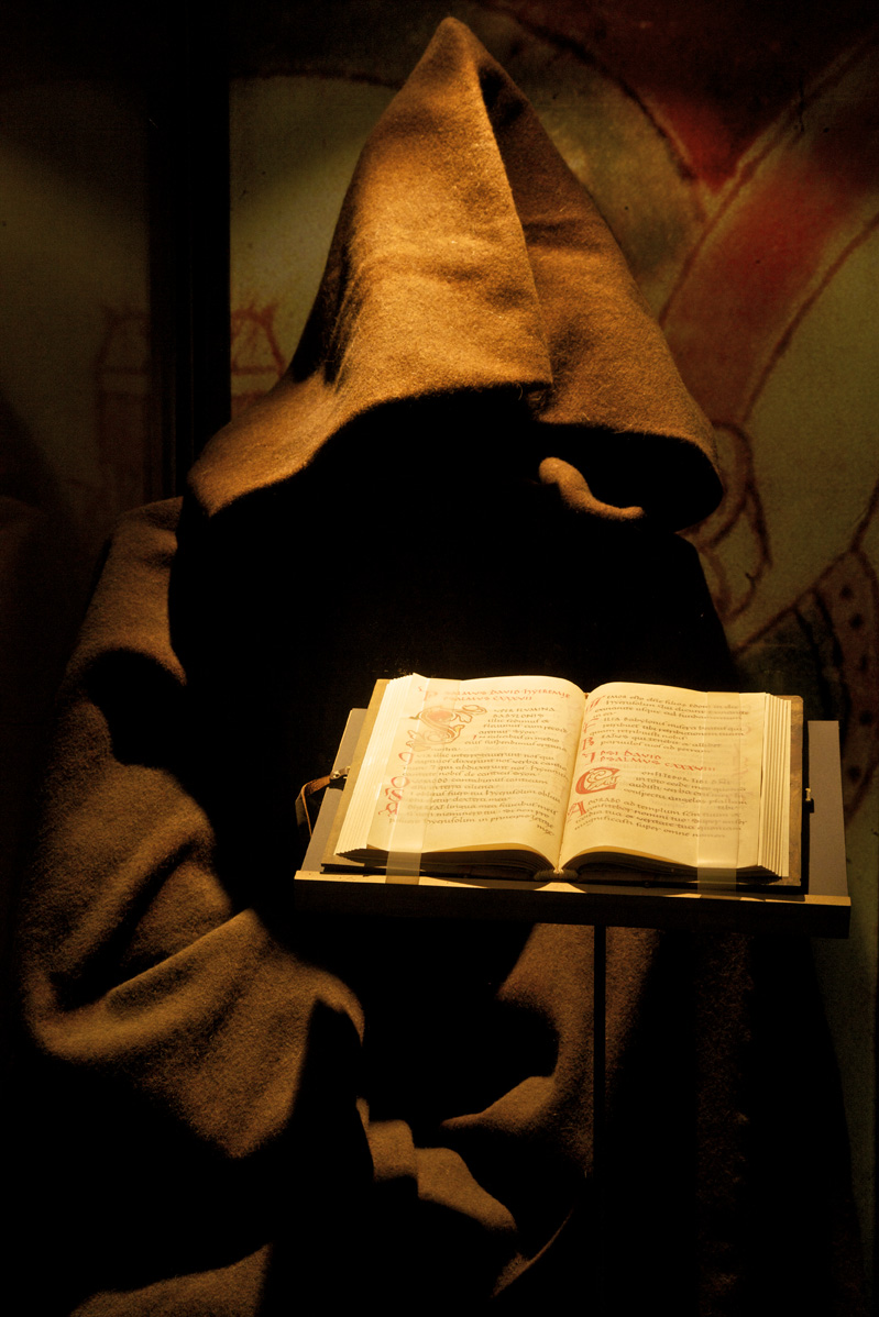
- The Scriptorium has a permanent exhibition dedicated to the monk scribes, who made the monastery one of the most important centres for producing and copying medieval manuscripts in Europe.
- Ripoll’s Ethnographic Museum opened in 1929 and was the first ethnography museum in Catalonia. Here you can learn about society and popular culture in Ripollès and the Girona Pyrenees from the late 19th to the end of the 20th century through the museums’ collections. Highlights include the collections on the Catalan forge and firearms forged in Ripoll, the lives of shepherds and farm workers and collections devoted to old trades, folk religion and the region’s legends.
Carrer dels Pirineus
Along this street was the wall’s moat (also called valley). It was a ditch dug into the ground next to the wall, and its purpose was to strengthen the wall and to protect the most vulnerable side of the town, since the river, a natural defense, did not pass along this side. Parallel to the moat was a path outside the walls that went from the Portal de Sant Pere, located next to the church of Sant Pere de Ripoll, to the Portal de l’Almoina, near the Raval bridge.
House of Dorctor Agustí
A Modernist building from 1902 designed by architect Antoni Coll i Fort. The house, built at the request of the industrialist Josep Buixó i Costa, was acquired by Doctor Jaume Agustí i Trilla and his wife, Concepció Segarra Vives, in 1919. The south and west façades display a great ornamental richness.
Although the name of this building is Casa Buixó, in 1911 Doctor Jaume Agustí and his family moved in, which is why it is commonly referred to as the House of Doctor Agustí.
Passeig Santa Joaquima de Vedruna
The Almoina canal once ran along this path. Its water came from the River Freser, and was used for different purposes, from farming to domestic use and later for use in the Palau Forge. When the Palau Forge was closed in the 1970s the canal fell into disuse, although water still circulated through one part of it.
Today, having been reopened by students of Vedruna School, it is a very pleasant walk. This initiative was brought about as part of the 160th anniversary of the founding of the Vedruna School of Ripoll, one of the few schools named after a woman. Protecting the environment and raising awareness about it was very important for this project.
The legend
Ripoll is where the two main rivers of the region, the Ter and the Freser, meet. According to legend, at birth, the rivers had a contest to see which of the two would reach the sea. The first one to reach Ripoll, the first milestone, would continue on to the Mediterranean Sea. The Freser descended quickly through the gulches and cliffs of the Ribes valley, but, tired from the effort, had to stop and rest. The Ter descended quietly, but did not stop for one second, passing through the Camprodon valley, and was the first one to reach Ripoll, thus winning the contest. The Ripollès region is a land rich with legends that relate to water. Part of the local folklore in the region includes stories about snakes, water-women, enchanted people (mysterious beings who live in places out in the wild, like springs, gorges, caves…), demon gorges or bridges built by the devil.
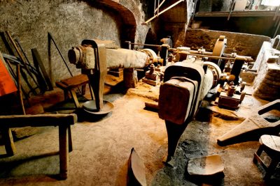
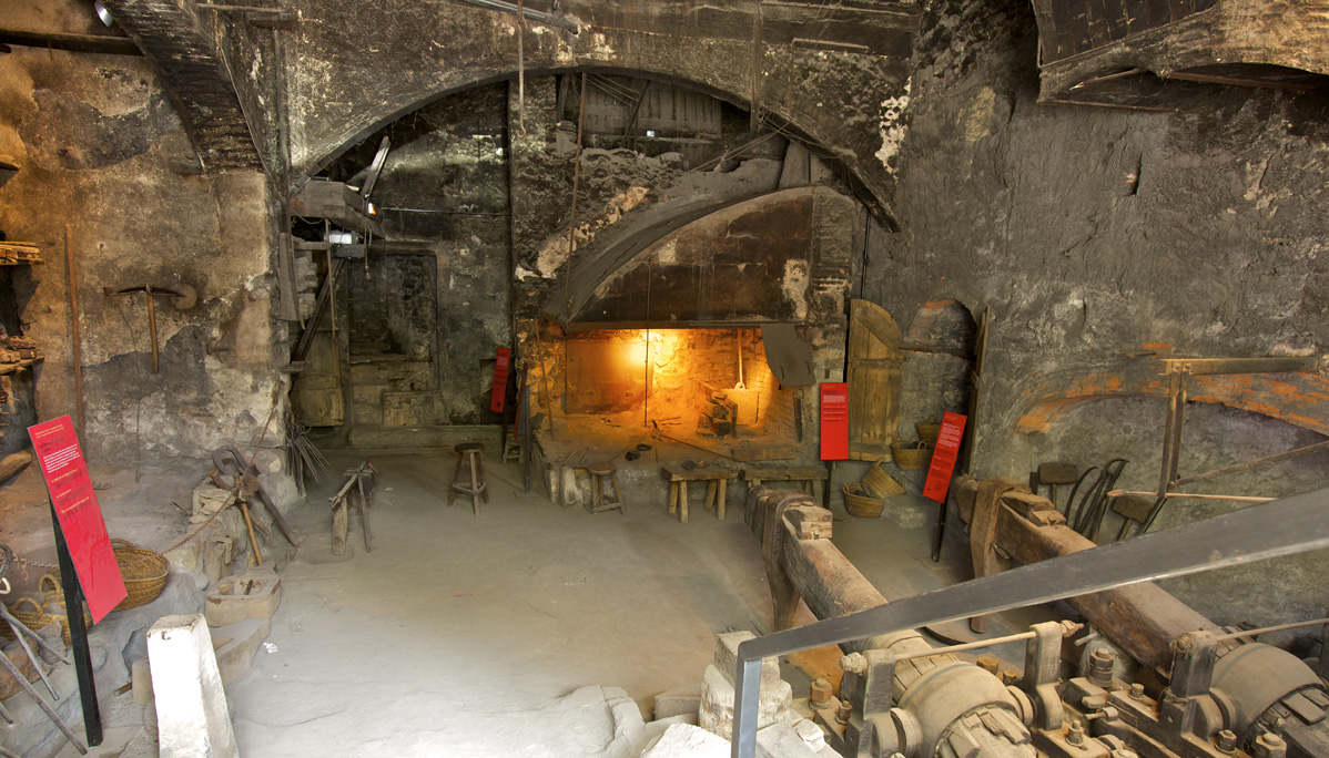
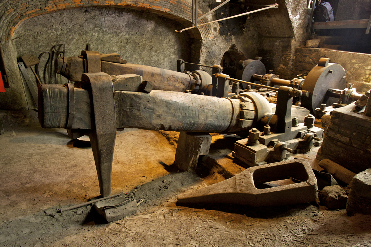
Forja Palau
Throughout history Ripoll has been the cradle of Catalan protoindustrialisation, home to a myriad of industrial activities.
Ripoll’s Palau Forge is one of the latest examples of an industrial presence in Ripoll.
The Catalan forge played a very important role in the industrial development of iron production during the 17th and 18th centuries. The most important products from the forge were firearms, nails and railings.
In general, the forges were located close to rivers, so as to use their water power, and outside towns’ ramparts, as they were noisy and presented a fire risk.
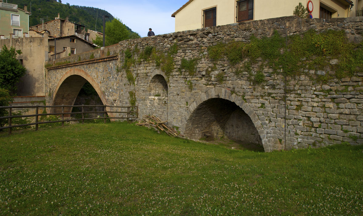
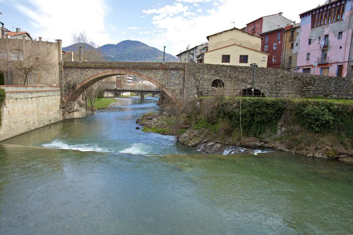
Raval bridge
This stone bridge over the River Freser currently links the Raval neighbourhood to the old centre. It was once a busy bridge, being the point of arrival and departure from the royal road to Barcelona. Prior to the 19th century it was one of just two points from which people could enter the town.
The houses of the Raval formed a neighbourhood situated outside the towns’ ramparts. There are dwellings there at present. You can also see the Raval water fountain, and at the Arquet bridge junction, the remains of those ramparts on the other side of the river.
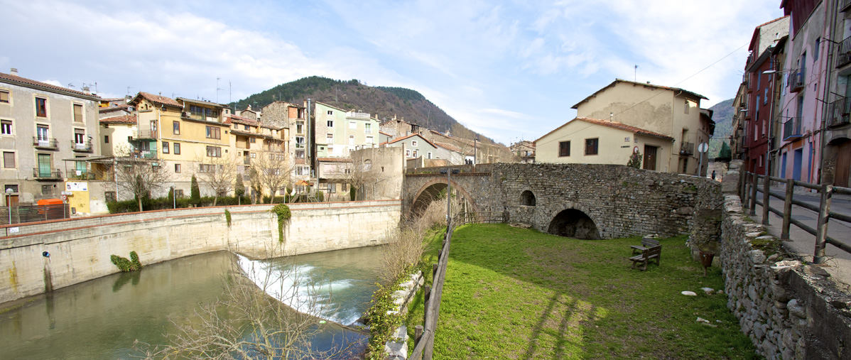
14th century wall
Various parts of the wall, made with pebbles, which surrounded the town of Ripoll from the Middle Ages until the mid-19th century, are scattered around different parts of the town.
We find sections with merlons in various places: along the Freser River, between the Raval bridge and the Arquet bridge; also along Carrer de Mossèn Cinto Verdaguer, at Casa Budallés, currently the Ethnography Museum, and between Carrer Trinitat and Carrer Pirineus.
Devesa del Pla
The name of this space comes from an old textile factory called ‘El Pla’ which was in operation until just past the turn of the century. It offers a good example of Ripoll’s industrial tradition: making good use of its location near the River Ter to channel water in via canal from the confluence of the rivers Ter and Freser.
Previously, this space had had different uses: for vegetable gardens, as the area in which funfairs were set up for the local festival and more recently as a botanic park where you can see the vegetation typical to Ripollès.
With the recent remodelling of the old factory, it is now a good place to go for a walk and cultural, commercial and festive stalls are often set up there.
Calatrava bridge
This bridge, built around 1990, is named after Santiago Calatrava, the renowned architect who designed it. The people of the town had long been calling for a bridge to connect the Carretera de Barcelona neighbourhood to the Estació neighbourhood.
The bridge’s walkway is made of wood from Canada.
On the bank opposite the Parc Botànic you can see a Romanesque Revival building which is part of the old Ripoll railway station on the route from Barcelona to Latour-de-Carol. It subsequently housed railway workers and is currently abandoned.
Trans-Pyreenes station
The Trans-Pyrenees station, or what was then called Ripoll New Station, was built in 1925 as a station for the Ripoll to Puigcerdà line. It is an emblematic building in the town, which bears some resemblance to the monastery. The building never functioned as a station, since it was built on the other side of the road, making it impossible to get to. It was intended to be one of the main railway service points on the international line, but until 1940 it was used as housing by RENFE workers.
Ter and Freser River Fauna
With the town of Ripoll situated between the Ter River and the Freser River, the courses of the rivers have become integrated into the urban fabric. Nevertheless, these rivers are home to a variety of fauna and flora unique to the river ecosystem. Along both rivers, the Ter and the Freser, as they pass through Ripoll, there are species of native flora, such as alder, poplar, white willow, maple and hazelnut trees; and species of fauna that include the mallard, the grey heron and the cormorant.
Sant Miquel de la Roqueta
This is an Art Nouveau-style chapel (1912), designed by the architect Joan Rubió i Bellvé (disciple to Antoni Gaudí). This dry-stone construction acted as a test-run for his subsequent great works. The front entrance takes the form of a catenary arch, which is very characteristic of Catalan Art Nouveau. It has a striking tower with a conical top.
Marià de Delàs built it in the place of an old chapel dedicated to Saint Michael. The Delàs family coat of arms can be seen over the arch.
Last sunday of September, the Sant Miquel de la Roqueta Festival is celebrated.
The chapel is listed as a cultural asset of local interest.
County Archive
The Ripollès County Archive is housed in a building that was originally the Ripoll hospital. The earliest reference to it dates from 1573 when, on the initiative of the abbot of the Ripoll monastery, Climent Mai, with contributions from Ripoll residents, the hospital was built by the side of the royal road. The building was destroyed during the Reapers’ War and the first Carlist War. In 1846 it was rebuilt for the last time and operated as a hospital and nursing home until the 1980s. The building is 740-square meters in size.
The archive’s main purpose is to preserve, conserve and disseminate documents of historical or cultural interest to the county, from Ripollès institutions and other public and private organizations.
Passeig Llegonet
This approximately one kilometre long path connects the Passeig del Mestre Guich to the beginning of the Iron and Coal Route (Can Guetes) that leads to Sant Joan de les Abadesses.
The route tracks the River Ter closely and the old Llegonet fountain has been salvaged. The fountain at the path entrance had got buried over time, its original vein lost. It has now been placed on the Llegonet path to make it accessible to everyone who passes by.
This path allows pedestrians and cyclists to avoid the Honorat Vilamanyà road and enjoy the wildlife on the river bank.
CAT Can Guetes (Idem Stop 1, circular route)