The Secret of Sant Pau de Segúries
Surrounded by rounded hills and beech forests, Sant Pau de Segúries is made up of the town centre, located on the left bank of the river Ter, and the neighbourhood of La Ral, located to the right of the river some 2 km to the north. The gentle relief, the humid terrain and the sunny climate have meant that, for many years, the economic activity in the area has been based on agriculture and livestock farming. Still, it has also been a place of passage. This is evidenced by the abutments of the old Rovira bridge (14th century) and the Roman road. Thanks to the river Ter, flour mills and two hydroelectric power stations were built in the area (20th century). The interest in mining gave rise to cement and carbide factories.
The town centre of Sant Pau de Segúries was rebuilt in the 17th century from the remains of the old fortified centre (12th century), which was practically uninhabited due to the plague and the earthquake of 1428. The Romanesque church was built at the crossroads of the Roman road with the rectory, the cemetery and the old inn, while the inhabited town was located next to the river and was left without a church until the 20th century.
Kilometers 1,4 km (round trip)
Difficulty Minimum
Pavement Natural route
Maximum altitude 843 m
Minimum altitude 827 m
Transport walk or bike
Secret type River paths
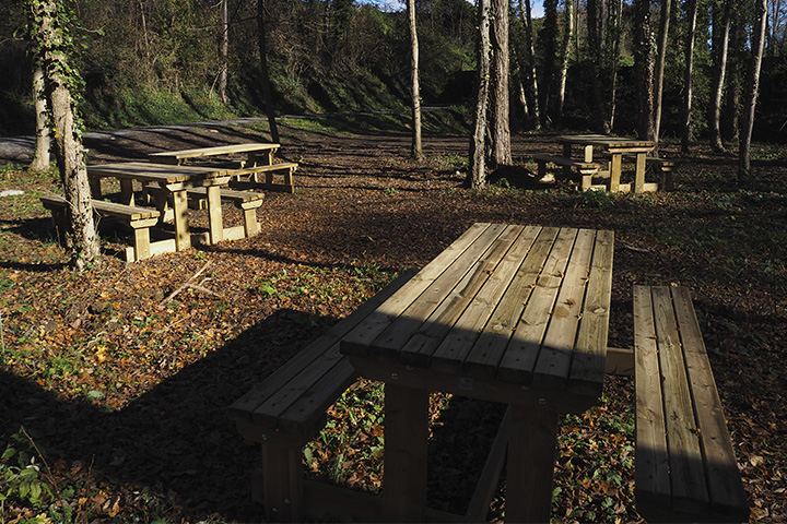
Sant Pau de Segúries is closely linked to the river Ter. All you have to do is walk along the banks of the river and you will see a river landscape with a rich natural and cultural heritage, a legacy of the longstanding relationship between the river and the town. The southern path of Can Brandia is part of this rich and complex river landscape in which, through various human remains, you will learn about the historical relationship between the river and the inhabitants who have occupied it over the centuries.
Thus, this route hides traces of this relationship between the river and the town, of the use of water to make electricity and ice, which have been prized throughout history, but also of old bridges that, like today’s bridges, sought a way to cross from one riverbank to another. At the same time, this human landscape is surrounded by precious riverside vegetation, a rich yet fragile ecosystem that must be preserved.
POINTS OF INTEREST
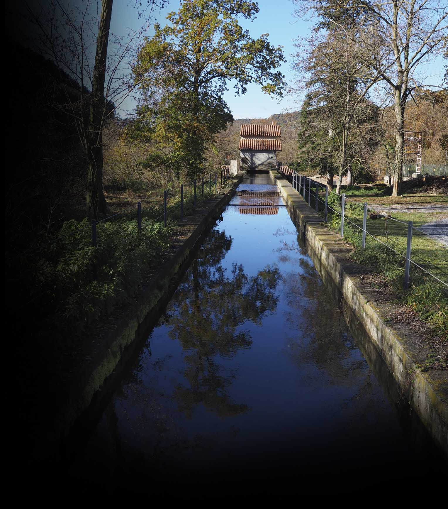
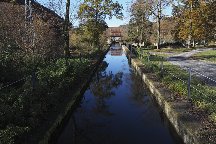
1. Can Brandia power station
This hydroelectric power station was built in 1896 as a result of a project by Ramon Brandia to harness the water of the river Ter for a textile factory that was never actually built. Despite this, the power plant came into operation and continues to produce electricity. It is a complex made up of several buildings, located on different levels and connected by an external staircase surrounded by formerly landscaped grounds. On the ground floor is the power station itself, made of stone and with openings marked with red tiles; on an intermediate level, there is the power plant manager’s house, while on the upper level is the house designed for the factory manager. Inside the power plant, the various floods it has suffered (1982, 1986, 1977, 1970 and 1940) are marked.
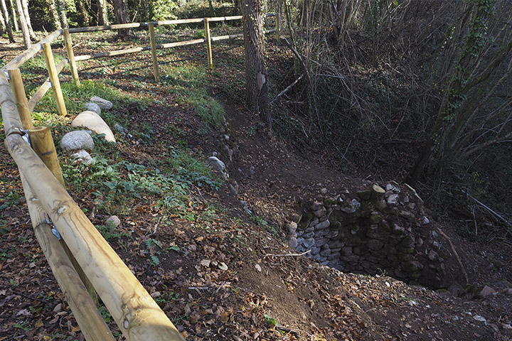
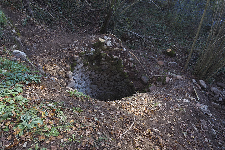
2. Ice pit
Ice and snow pits were circular stone constructions with a vaulted roof, located in shady spots near watercourses, which were used to store ice or snow in winter so that it could be used and sold at any time of the year. In Sant Pau de Segúries, the remains of one of these pits have been preserved. It made use of both the snow that fell in winter and the ice that formed in the river Ter.
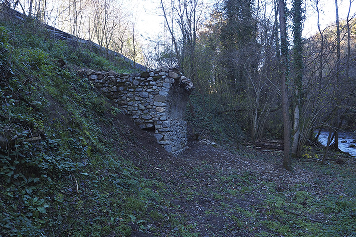
3. Callís bridge
This bridge is actually the remains of an old, unfinished bridge that the owners of the neighbouring Callís farmhouse began to build in 1923 in order to cross the river Ter and gain access to their properties on the other side of the river. Disagreements with the builder led to the interruption of the work, which was never resumed.
(Text taken from the town’s tourist boards.)
4. River Ter – Xarxa Natura 2000 protected area
The Protected Natural Area of the Upper Ter Riverbanks (ES5120019), part of Xarxa Natura 2000, is a fluvial space of permanent waters with riverside forests at the headwaters of the River Ter. It is a protected natural area that encompasses the banks of the river Ter from the municipalities of Camprodon, Sant Pau de Segúries, Sant Joan de les Abadesses and Ripoll. The river areas, historically used for timber production, farming and water channelling, are of great value due to their unique vegetation which, among other things, acts as a major biological filter. The alder (Alnus glutinosa) has become a key element in the identification and protection of this natural area.