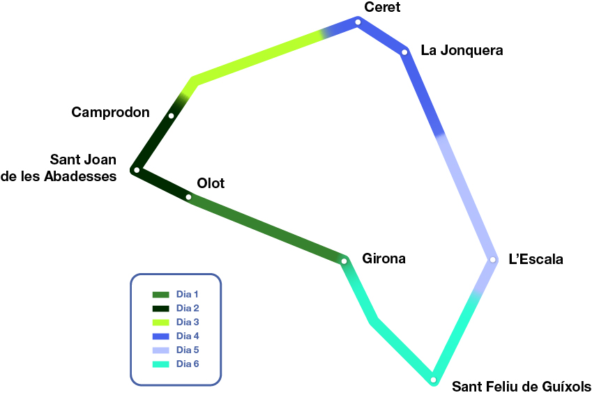
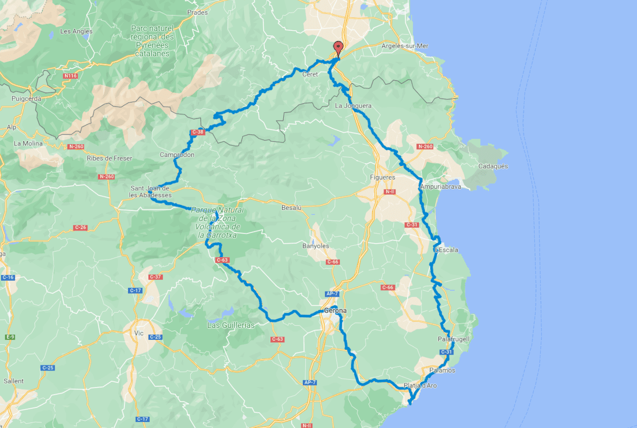
Pirinexus route (6 days)
Circular route
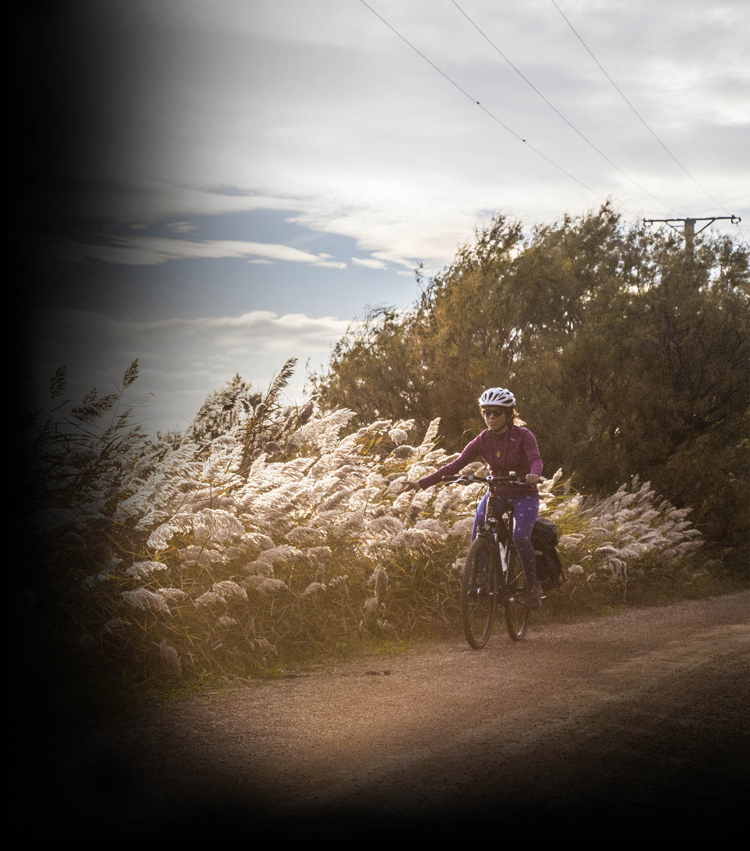
Completing the Pirinexus over six days allows you to enjoy the route and its surroundings at a more leisurely pace. With an average of 50 kilometres per day, you will discover additional cultural, natural and gastronomic attractions along the route.
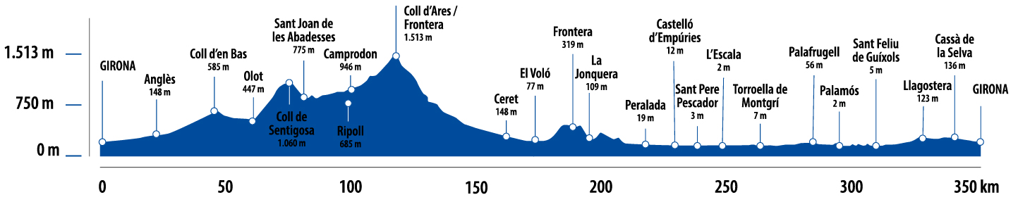
Kilometers 340 km
Difficulty Average
Pavement Asphalt, sand, compacted sand
Maximum altitude 1510 m
Minimum altitude 0 m
Transport Bicicleta
Day 1. From Girona to Olot (69 kilometres)
The route starts in Girona, following the Carrilet I Greenway towards Olot. The Carrilet I Greenway is an old railway line with a low gradient that runs through an area of great natural and heritage value. The greenway reaches Olot, which is of great geological and scenic interest. We recommend visiting the volcano interpretation centre to get a better understanding of the town’s surroundings. Also worth mentioning is the volcanic cuisine, which promotes local ingredients and cuisine.
Day 2. From Olot to Molló (45.7 kilometres)
Leaving Olot, take the N-260, which climbs up through the Coubet and Santigosa passes to Sant Joan de les Abadesses. This section of the route is on tarmac, with an average gradient of 4% over 22 kilometres. In Sant Joan de les Abadesses we recommend visiting the old town following the route of the Secret of Sant Joan de les Abadesses.
Next, take the greenway to Sant Pau de Segúries and cross the main road to take an uphill path that will take you to Camprodon. Leaving the town, once you have passed the Ritort river, you will begin to see typical high mountain landscapes. This second stage ends in Molló.
Day 3. From Molló to Céret (55 kilometres)
The third day begins with a climb to Col d’Ares. At 1510 metres, it is the highest point on the route and the border crossing to France. This pass is notable for its history as an escape route to exile during the Spanish Civil War. At the top of the pass, there is a memorial to these exiles.
Once past this point, the descent to Céret begins, crossing the Vallespir region. Céret is a charming town famous for its cherries.
Day 4. From Céret to Peralada (52.1 kilometres)
The fourth stage begins in Céret, along paved uphill trails as far as Col de Panissars (361 metres) to cross the border again. It should be noted that during times of high forest risk, the pass may be closed, with a properly signposted alternative route on the French side. From here, the descent towards La Jonquera begins. This is the most technically difficult point of the route. The descent starts on a sandy forest path with a steep slope. It is therefore advisable to ride with caution along this stretch of approximately 6 kilometres. Once you cross La Jonquera, the route continues towards the sea. Next, you will come across the towns of Campmany and Peralada, which stand out for their winemaking tradition, with wineries where you can enjoy a guided tour.
Day 5. From Peralada to Palamós (76.6 kilometres)
The route leaves Peralada and continues towards L’Escala. Before reaching the town, you will see the remains of the ancient Greek and Roman port of Sant Martí d’Empúries.
Continue cycling towards Palafrugell. This section runs along trails and secondary roads. This area is known for its long-standing agricultural tradition, especially its fruit orchards. In Palafrugell, take the Tren Petit Greenway, the old route of the little train that used to connect Palamós with Girona, passing through La Bisbal d’Empordà. This stage ends in Palamós, a town with a fishing tradition, where you can visit the Fishing Museum. Also, if the timing is right, we recommend attending the fish auction.
Day 6. From Palamós to Girona (52.85 kilometres)
Leaving Palamós, you will soon join the Carrilet II route, the greenway that connects Sant Feliu de Guíxols with Girona. This route follows the old route of the Girona-Sant Feliu de Guíxols narrow-gauge train, from the Ridaura river valley to the Ter river basin.
This stage and the route end at the same starting point: the city of Girona. It is well worth spending a day visiting the Old Quarter, particularly the Call (Jewish Quarter), the cathedral and the city walls. The city is also known for its wide range of restaurants and leisure activities.